At the Fault Lines
on Center for Spatial Research
Research published by
Columbia CSR on designing an AI-powered
earthquake risk assessment map. Read here →
FaultLines Awarded 1ST Place at Columbia Startup Competition
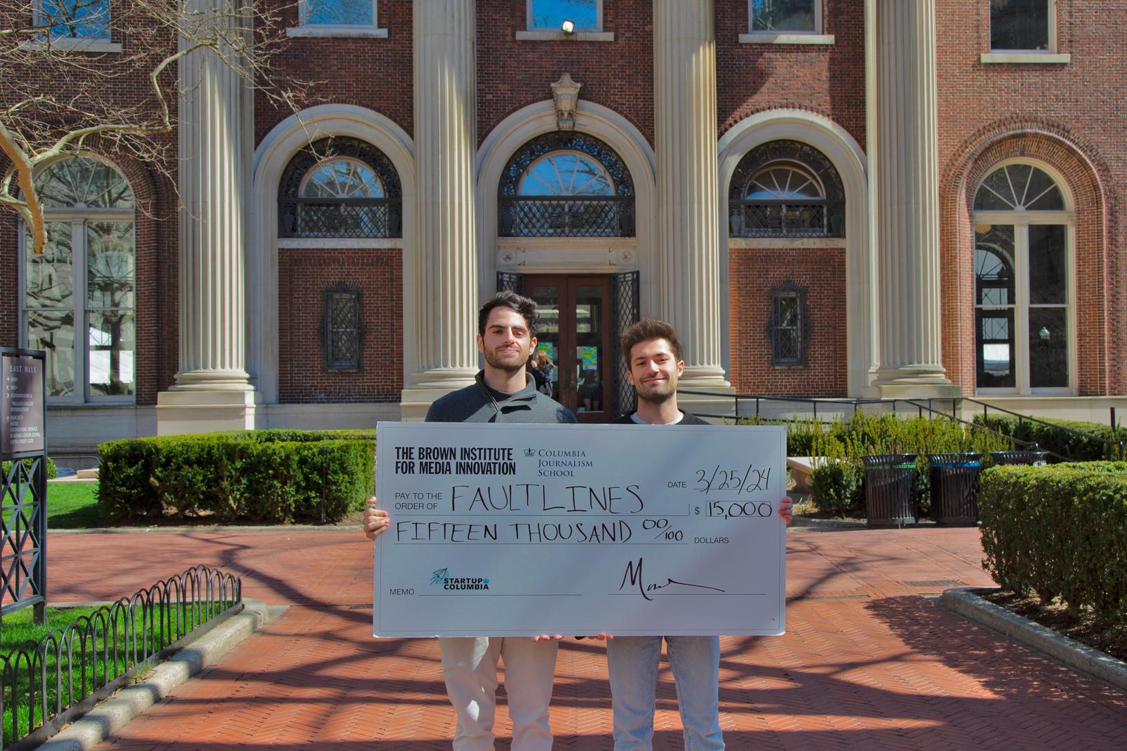
FaultLines, an AI-powered geospatial information and earthquake risk assessment platform, awarded first place at the Startup Columbia Venture Challenge 2024 in the Media Track, sponsored by the Brown Institute for Media Innovation of Columbia Journalism School and Stanford Engineering School. Read more on Columbia GSAPP →
Metamart
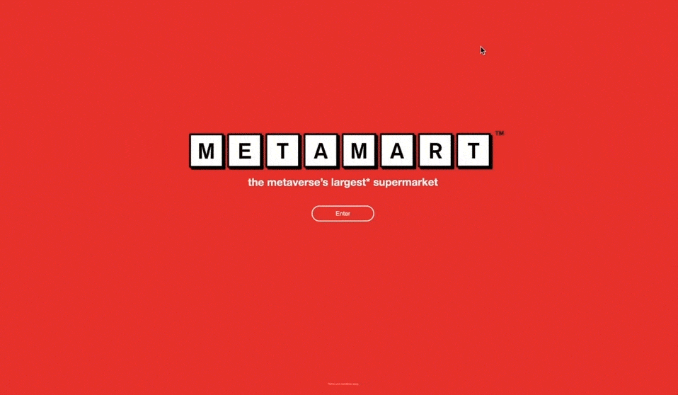
A work-in-progress user experience design project that reimagines the online shopping interface and experience based on digital-spatial analogy study of the spatial experience of the common grocery store. Designed and developed as part of Columbia GSAPP Coding for Spatial Practices course taught by Celeste Layne. See it here →
Recombinant Renaissance
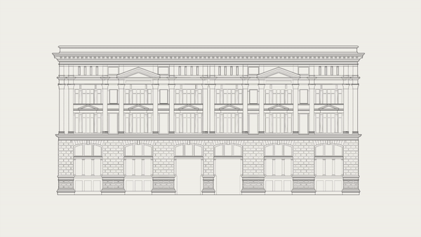
An animated visual exploration to the Ottoman Bank Building, or SALT Galata Research Center, designed by French architect Alexandre Vallaury in 1892 - an eclectic building in Istanbul with highly distinct north and south facades in architectural expression, political identitiy, and spatial organization. See courseworks →
Geographies of
Data, Sand, and People
Archiving, a practice and act of preservation that is as old as history itself, is now being redefined as traditional archival media have fast evolved into novel storage devices of today.
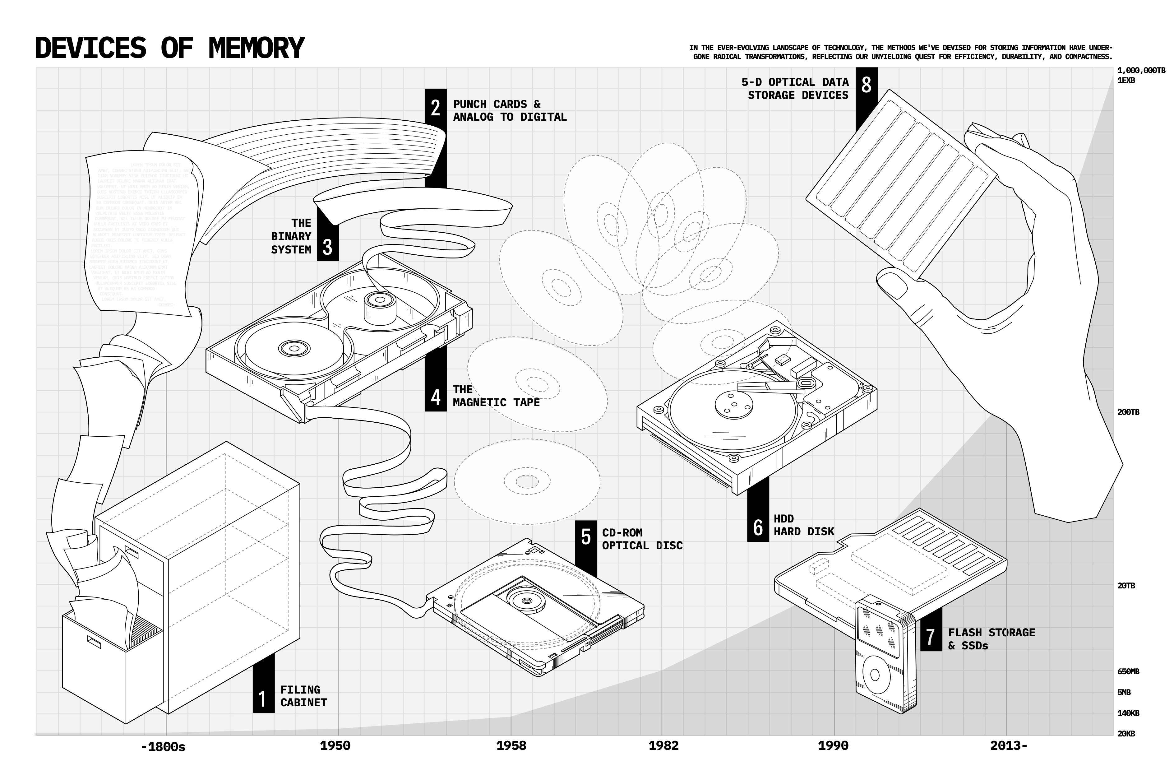
Devices of Memory, Geographies of Data, and Tracing Sand, Data, and People are three interdisciplinary mapping projects that aims to delve deeper into the politics of data, archiving, and identity.
Project to be uploaded soon.
Making Bricks
from Crops

Repurposing agricultural waste in India’s Punjab region into construction materials, textiles, and other financially valuable assets for agricultural communities. See material research →
At the Fault Lines:
Research + Development Blog
R+D blog for the Geospatial AI research
supported by the Center for Spatial Research.
See here →
Data Mourning:
The Library for Territorial and Environmental Sensing
Tuvalu’s appeal to the world at COP26 calls us to reinvestigate how “territory” defines a “state.” The government has recently announced their attempt at becoming the First Digital Nation by creating a digital twin of themselves, a project by Accenture. “Territory” has been considered an essential component of the legal definition for a “state” as evidenced by the Pan-American convention on the Rights and Duties of State. Thus we’ve approached Tuvalu’s situation with the question, “how does the movement of sand, people, and data redefine territory?”
In collaboration with Will Cao and Ammar Hussein Rassai, for Advanced V Studio directed by Marina Oterto Verzier.
Project to be uploaded soon.
Manual 10-222:
A Prototype Half-Village
Housing, Inc.
Created as part of Columbia GSAPP Core III Housing Studio, this project tackles the challenges accomodating affordable housing for living, producing, and socializing all within one micro-urban housing complex. In collaboration with Katerina Gregoriou, for Core III Studio directed by Benjamin Cadena. Read more →
Creating New York City’s Dateability Index
Many people flock to big cities not only for better job prospects but also for a more vibrant social life and a higher chance to find their significant other(s). However, cities have also become massive, complex, and virtually endless entities in which where you live, who do you interact with and even the daily commute are all seemingly small things that can have a massive impact on one’s romantic life. As part of this class, I will try to break down such factors that affect the chances of having a successful date, and try to find those that are related to the urban environment to create a tangible index of “ZIP Codes with Better Chances of Having A Successful Dating Life”.
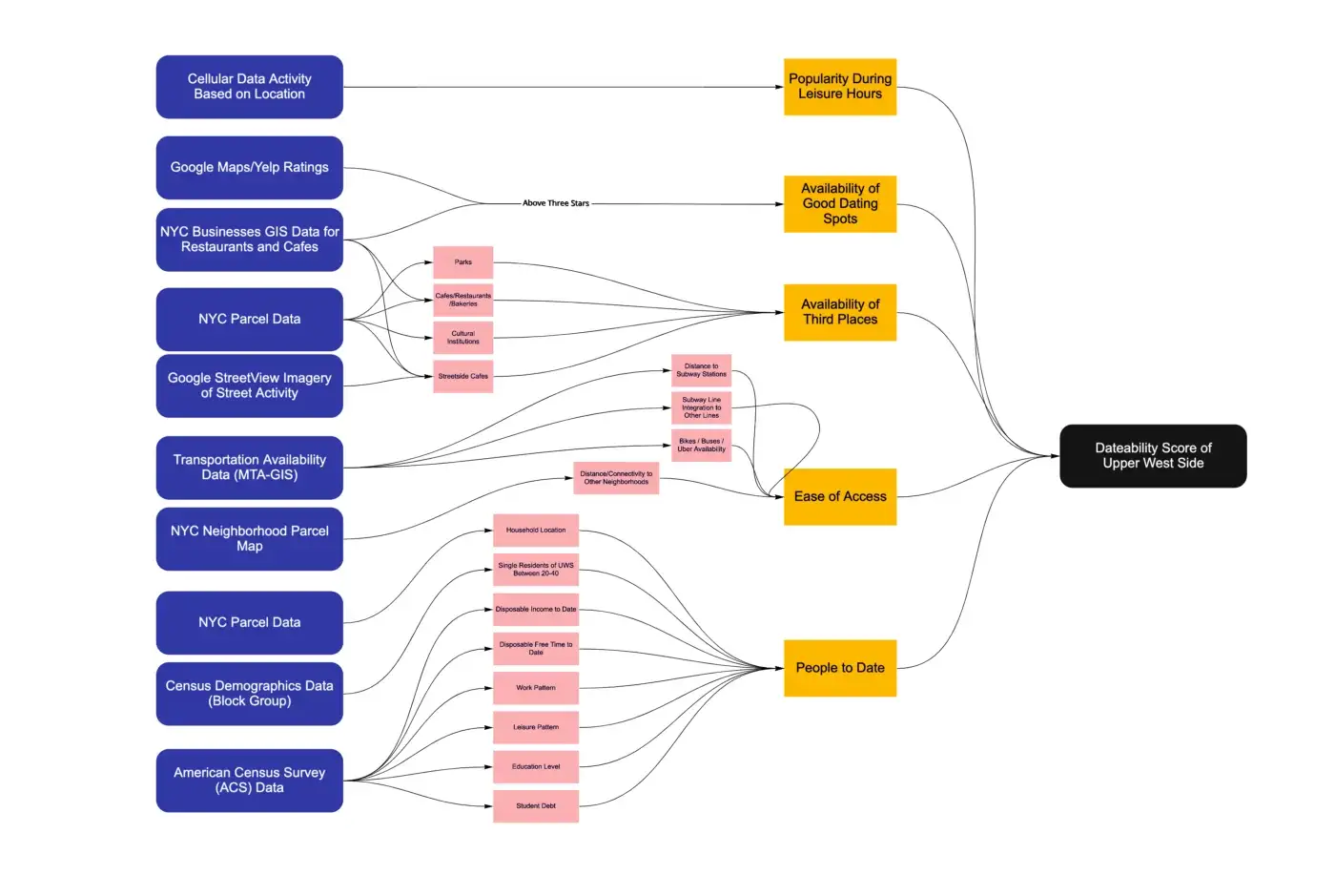
Although dating behaviors vastly differ from person to person, what this study aims to focus on is to identify average universal contributing factors that a neighborhood might have on a person’s dating life. Hence, very important coefficients such as physical appearance, race, preferences, sexual orientation etc. are excluded from this conceptual map. Read More →
Mapping the
Flood Paths of Istanbul
Could understanding how water moves across the city’s topography to prevent future flooding?
Istanbul is most-famously known for its location on the Bosphorus, the grand water way that runs through the city, cutting the city founded on grand topography in half. As much of an attraction for many, its distinct geographical features and unplanned urbanism have long disarmed the city against heavy rain and flooding.
This project maps out the natural flood paths of a Bosphorus neighborhood, Taksim, Dolmabahce and its precincts, to analyze the contrast between water flow and the urban grid.
Keep reading on Medium →
Elevators on Stimulants:
Supercharge Your Hellishly Slow Elevator
Elevators on Stimulants is a multimodal AI tool that supercharges any given elevator by gathering, processing, and drawing upon spatial data.
EoS uses hardware sensors (i.e. closed circuit camera systems, webcams, cameras, microphones) along with various multimodal AI models for semantically generating a temporal crowd network dataset, to further train these models for pre-emptive spatial arrangement of the elevator cabin, at the right spot and the right time. See GitHub Repo for more information, and a manual to run your own EoS demo right away. In collaboration with Gio Kim and Maithili Jain.
Project to be uploaded soon.
Simulating Squirrel-Human Interaction in Central Park
This project explores the impact of human activity on urban wildlife in New York City, focusing on the interactions between squirrels, pets, and human amenities in the southwest corner of Central Park.
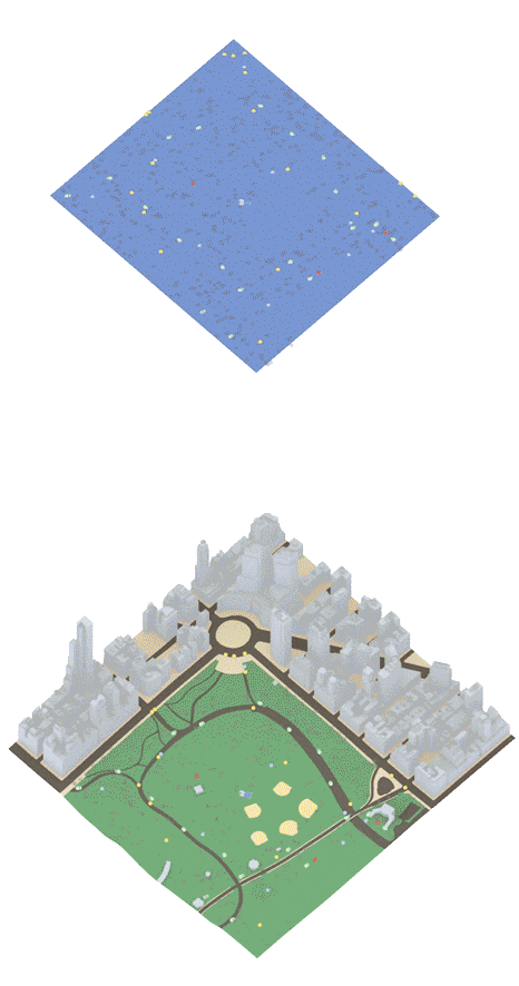
By analyzing squirrel behavior data and simulating their movements in response to factors like trash collection, dog activity, and food truck locations, the project aims to identify potential adjustments to human amenities that could reduce human-wildlife conflicts. More importantly, watching squirrels walk around a virtual slice of Central Park is just real fun. Keep reading on Medium →
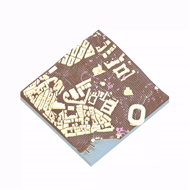
Machine Generated City of New York
Machine-generated axonometrics from real-life addresses unveil how our collective online data translates into machine-produced drawings.
Making Floor Plans More Legible and Fun
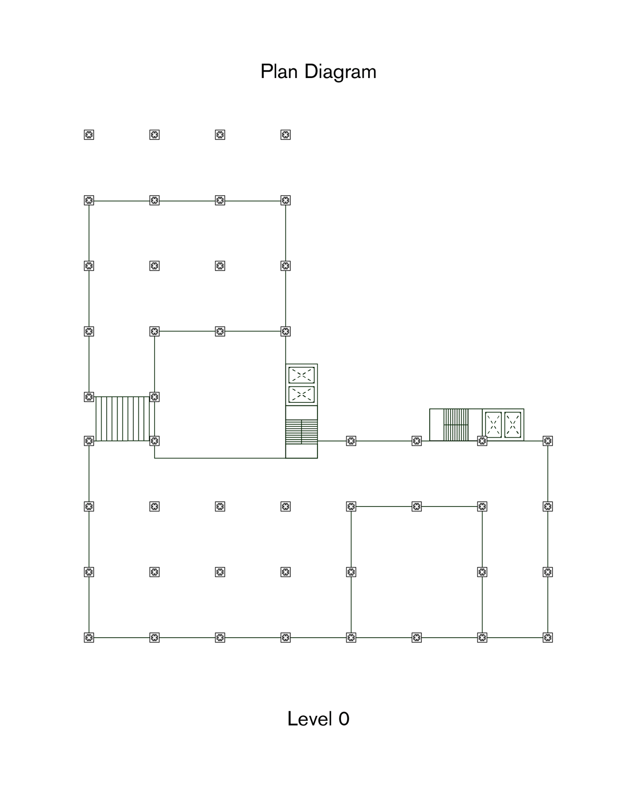
The Plug-in School is a complex project that featured a complex network of vertical floor planes, which in return required a complex set of floor plan diagrams. Created as part of Columbia GSAPP Core II Studios, these floor plan diagrams are an architectural representation exercise that stresses the common drawing methods and explores a more legible and fun way of drawing and looking at architectural drawing sets. See more →
Work in Progress:
Things of New York City
Things of New York City started as a personal library of everyday items from the streets of NYC: Streetlights, USPS post boxes, traffic barriers - anything and everything New York.

Things of New York City is an online archive of hundreds of iPhone LiDAR-scanned 3D models of New York City artifacts - coming soon. Here’s a link to the upcoming webpage →
A Public Pool
in Inwood, Manhattan
Stitching the long-separated sides of Inwood, a neighborhood that’s at the northernmost end of Manhattan, back together around having good conversations, fun evenings, and chill summer evenings by the pool. Read here →
The Cherrytree Machinery: Can Computers Save Our Neighborhoods?
What is the toolkit of an architect/planner when reimagining the future of the built environment -and how could the emerging data-driven technologies contribute to these tools that can augment designers’ impact scale and efficiency?
The Cherrytree Machinery is a Python-based micro-software that analyzes complex urban elements and suggests interventions that could be employed by a designer towards designing more equitable, sustainable, and resilient cities. Read more →
When the Machine Makes Architectural Models
Model making is an inseparable part of the architectural design process that is essential to understand the overall form and performance of a building before construction. Although digital modeling practices have been getting increasingly more common place, due to its tactile nature it remains a fundamental part of any design process.

Transforming a model into a finished design, however, is a costly, time-consuming and laborious process that takes countless design meetings, iterations, and start-overs. Hence, even the most “corporate” design studios employ intermediary practices like mood boards, collages and tools like Pinterest before moving forward with the final design; to better visualize their ideas for the client to approve. We think AI could offer a powerful workflow that bridges this gap, so that designers can make design decisions faster, and with more confidence. Read More →
Reimagining ‘Home’
A library of housing units designed as part of Core III Housing Studio at Columbia GSAPP. These units are designed to maximize the amount of serendipitious encounters among building tennants.

16 different types of units were generated with aspects such as future-expandability, financial legibility, and equitability considered in mind.
Not only the Floor Area Usage is maximized for efficiency and mixed indoor-outdoor usage where neighbors can come together; but also designed within a generative geometry that creates “social” nooks and crannies when housing units are brought into their “housing-complex” state. Read more →
The Public Authority
of Environmental Acts
A speculative project investigating capital, “money-politics” vs. “science-politics,” and how complex societal hierarchies are projected onto spatial qualities of spaces of decision-making. Read here →
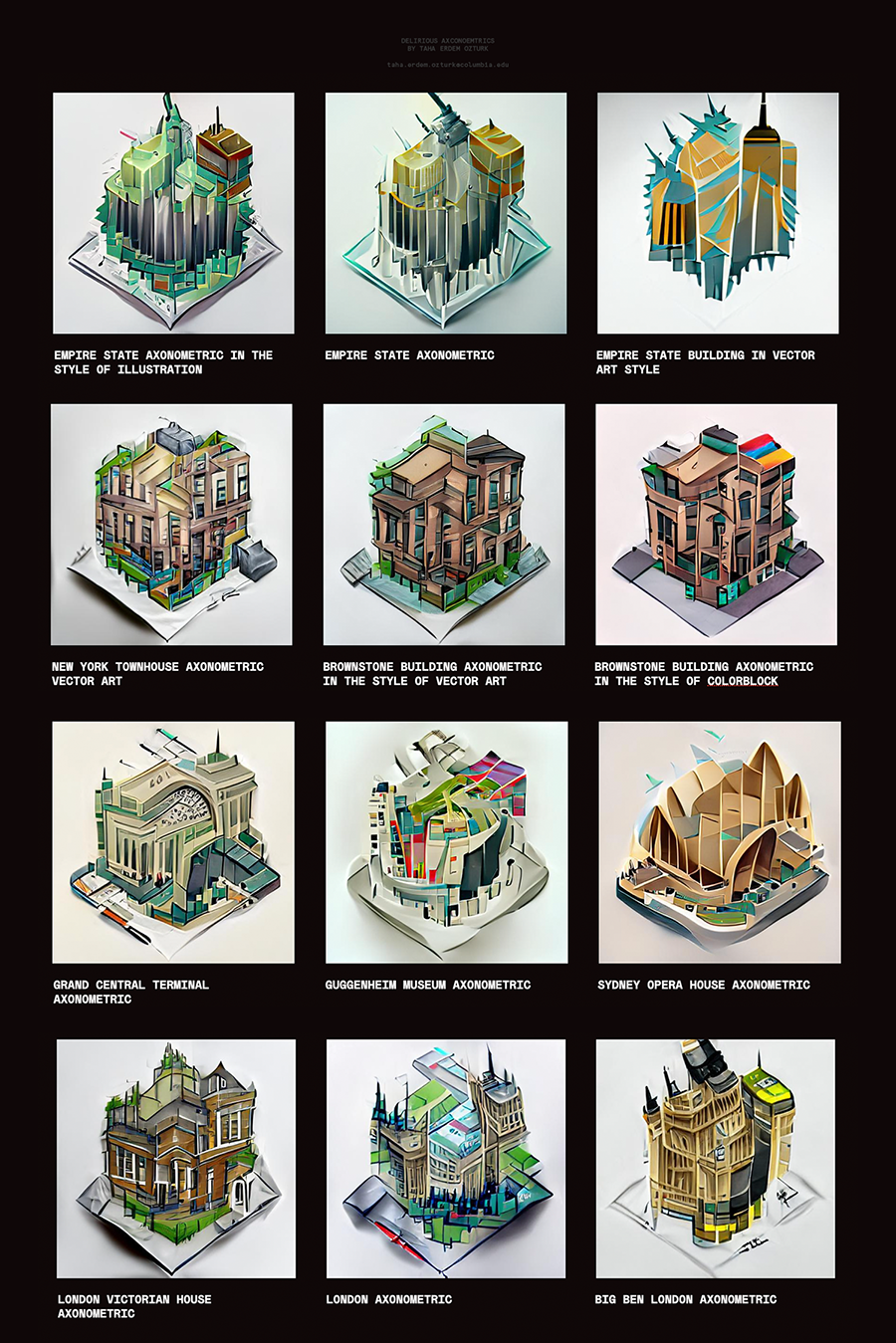
Delirious Axonometrics